Miami, FL – The latest Seven-Day Graphical Tropical Weather Outlook from the National Hurricane Center (NHC), issued on Saturday, July 12, 2025, at 7:36 PM EDT, indicates a developing weather system in the Gulf of Mexico that warrants attention, though the immediate threat of a named storm remains low.
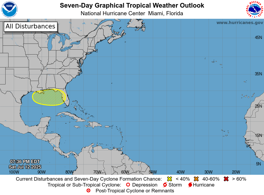
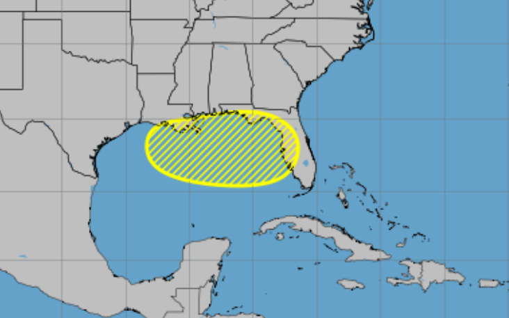
The graphic highlights a trough of low pressure expected to drift westward into the northeastern Gulf of Mexico by Tuesday. Currently, the NHC assesses a near 0% chance of tropical cyclone formation within the next 48 hours and a 20% chance over the next seven days for this particular disturbance. This low probability is visually represented by a yellow hatched area on the NHC’s outlook map, stretching across the Florida peninsula and into the Gulf.
What This Means for the Gulf Coast:
For residents along the north-central Gulf coast, including those in Tampa Bay and surrounding areas, the primary concern in the short term appears to be heavy rainfall and the potential for localized flash flooding. Even without the development of a tropical cyclone, the moisture associated with this system could lead to significant precipitation. It’s crucial for residents to stay informed about local weather forecasts and be prepared for potential flooding, especially in low-lying areas.
Implications for the Atlantic Coast:
Currently, the outlook does not indicate any significant tropical development posing an immediate threat to the Atlantic coast of the United States. The focus remains on the Gulf system. However, it’s important to remember that weather patterns are dynamic. The evolution of the Gulf disturbance could indirectly influence weather systems over the western Atlantic in the longer term. Residents along the Atlantic coast should continue to monitor future NHC updates.


Leave a Reply